
4. The Brahmaputra Plain
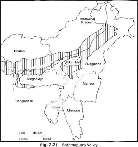
Stretching over an area of about 56,275 sq km, it is the eastern part of the Great Plains of India. It is about 720 km long and about 80 km wide. The region is surrounded by high mountains on all sides, except on the west. It is a depositional plain. The general altitude of the Brahmaputra Plain varies between 130 m in the east to only 30 m in the west (Fig. 2.21). The Assam Valley is characterised by a steep slope along its northern margin but the southern side has a gradual fall from the Meghalaya Plateau. The whole length of the plain is traversed by the Brahmaputra. Due to the low gradient, the Brahmaputra is a highly braided river having numerous islands. Majuli (area 930 sq km) is the largest river island of India and the second largest in the world after the Marajo Island of the Amazon River. The valley of Brahmaputra also has a number of isolated hillocks on both flanks of the Brahmaputra River. It is one of the most productive plains of India in which rice and jute are the main crops.
There is a marked difference between the physiography of the north and the south banks of the Brahmaputra river. The northern tributaries descending from the Arunachal and Assam Hills form a series of alluvial fans which coalesce and obstruct the courses of the tributaries forcing them to form meanders and adopt parallel course along the main stream, Brahmaputra. Consequently, there arc numerous levees along the north bank. This has led to the formation of Bits, ox- bow lakes, marshy tracts, and Tarai lands with dense forest cover. The southern bank of the Brahmaputra is less uneven and less wide. Moreover, the tributaries in the southern part are considerably larger. Here, Dhansiri and Kapili, through their headward erosion have almost isolated the Mikir and Rengma hills from the Meghalaya Plateau.
The valley of Assam may be divided into (i) the Upper Assam and (ii) the Lower Assam. These are demarcated along 94" East longitude. The Upper Assam Valley includes the districts of Lakhimpur, DibrugarhjJorhat, and Sibsagar and the Tezpur Tehsil of Darrang District. It is a monotonous plain except for the low hill ranges along the southern and south-eastern border. The Lower Assam Valley consists of Nagaon, Dhubri, Goalpara, Barpeta, Kamrup, Nalbari, Kokrajhar, and parts of the Darrang District. This region does not posses monotonous physiographic characteristics since its landscape is interspersed with the spurs of Meghalaya Plateau. Here, the right bank tributaries form a trellis pattern of drainage, while the left bank tributaries exhibit the dendritic pattern. Swamps and marshes are numerous in the northern region of the Lower Brahmaputra Valley.
The Brahmaputra-. It is one of the great rivers of the world. Flowing eastward to the north of the Himalayas in Tibet (China), it turns sharply south and passes through Assam before entering Bangladesh. The river valley has fertile alluvial plain which is conducive to growing rice and jute. It is also famous for its tea and the two national parks at Kaziranga and Manas.