
LAND UTILISATION
Land utilisation statistics are available for about 93 per cent of the total geogr aphical area (328.75 million hectares) of the country. The net sown area accounts for about 46.15 per cent of the total reporting area of India, against the world average of about 32 per cent. The general land use of the country has been given in Table 9.1 (Fig. 9.1).
Table 9.1 India-General Land Use in 2009-10
Land Categories | Area in Million Hectares 2009-10 | Percentage |
1. Total geographical area | 328.75 | |
2. Total reporting area for land use | 306.25 | 93.20 |
3. Area under forests | 69.00 | 22.55 |
4. Area not available for cultivation | ||
(a) Area put to non-agricultural uses | 23.25 | 7.61 |
(b) Barren and uncultivable land | 19.18 | 6.25 1 |
(Could.)
5. | Other uncultivated land excluding fallow (a) Permanent pastures and grazing lands (b) Land under tree crops and groves (c) Cuiturable waste | 11.00 3.62 13.83 |
6. | Fallow Lands | |
(a) Current fallow | 14.80 | |
(b) Other fallow | 10.11 | |
7. | Net sown area | 141.23 |
8. | Area sown more than once | 48.51 |
9. | Total (gross cropped) cropped area | 189.74 |
10. | Area under irrigation | 78.00 |
3.61
1.18
4.52
4.83
3.30
46.15
32.60
55.3
Source: Statistical Abstracts of India—2005-06, Govt, of India Publication.
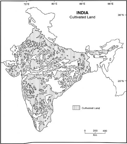
Fig. 9.1 Arable Land (2005-06)
It may be seen from Table 9.1 that over 46 per cent of the total reporting area was net area sown in 2005-06, and 32 per cent was double cropped area (Fig. 9.2). The forest occupied 22.55 per cent while 6.25 was barren and uncultivable land. The barren and wasteland occupy 6.25 per cent of the total reporting area Table 9.1 (Fig. 9.3). The various categories of degraded lands have been given in Table 9.2
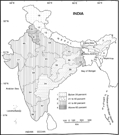
Fig. 9.2 Net Sown Area (2005-06)
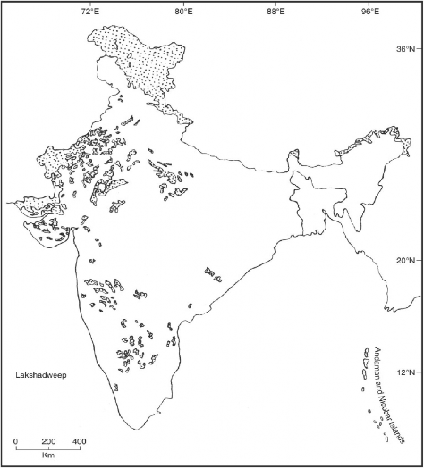
Fig. 9.3 Wasteland (2005-06)
Table 9.2 H/aste Lands and Degraded Lands
Type of land | Percentage |
Gullied land | 2.05 |
Land with or without scrub | 19.40 |
Water-logged and marshy land | 1.66 |
Land affected by salinity and alkalinity | 2.05 |
Contd.)
Degraded land & plantation crop
Source: Planning Commission, Government of India, Tenth Five Year Plan.
An examination of Table 9.2 reveals that land with or without scrub and degraded notified forests occupied 19.40 and 14.06 per cent of the waste land respectively. The reclamation of degraded and waste lands can help in increasing the agricultural land as well as in improving the ecology and environment.