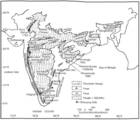
1. The North Central Highlands
The central highlands of peninsular India include the Aravallis, the Malwa Plateau, and the Vindhyan Range (Fig. 2.2).
(i) The Aravallis: It is a range that runs from north-east to south-west for about 800 km between Delhi to Palanpur (Gujarat). It is one of the oldest folded mountains of the world. Being highly denuded, its highest peak—Guru-Sikhar—is only 1722 metres in height. The Aravillis are mainly composed of quartzites, gneisses and schists of the Precambrian period. Northwest of Udaipur, the Aravallis are called Jarga Hills (1431 m). The Goranghat Pass separates Gurushikar from Mount Abu. The Great Boundary Fault (GBF) separates the Aravallis from the Vindhyan Mountains.
(ii) The Malwa Plateau: It is bordered by the Aravallis in the north, the Vindhyan Range in the south and the Bundelkhand Plateau in the east. The Malwa Plateau has two drainage systems, one towards the Arabian Sea (Narmada, and Mahi), and another towards the Bay of Bengal (Chambal, Sind, Betwa and Ken) joining the Yamuna river.

